
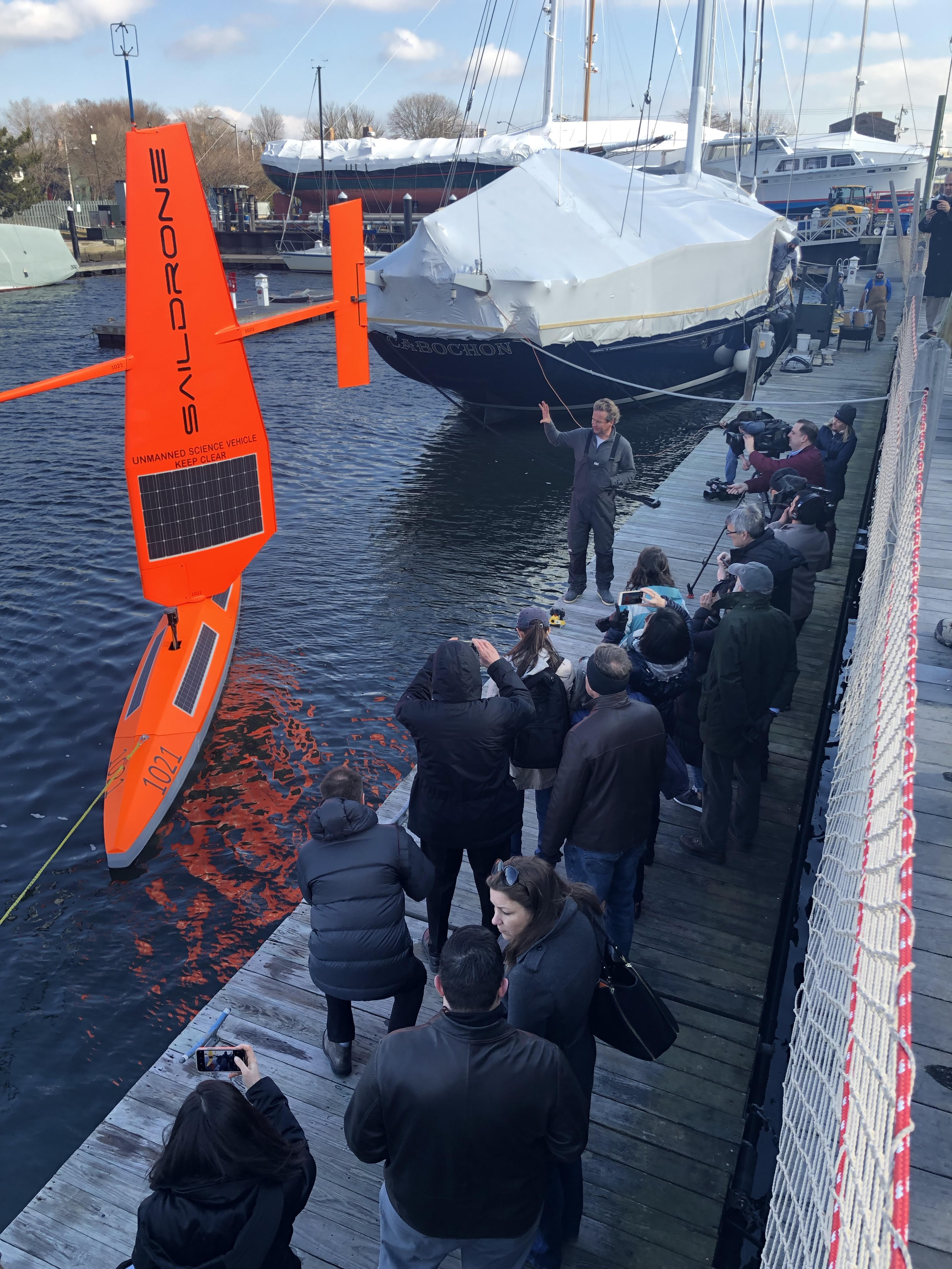
Photo courtesy of Newport Shipyard. A drone created by GSO professors set sail for a 30-day journey to monitor ocean carbon dioxide levels.
A University of Rhode Island Graduate School of Oceanography professor recently released a water-based drone that will study carbon levels off the coast.
Jaime Palter, an assistant professor of physical oceanography, will study the data transmitted by the drone over the course of 30 days. The drone, which is wind powered, is called a Saildrone.
Palter will be using the Saildrone to measure the carbon dioxide levels in the Gulf Stream. The Gulf Stream is a ocean current offshore that contains warmer than usual water.
“Even though it is freezing cold [recently], well below zero celsius or 32 fahrenheit, not too far offshore the water is almost 70 degrees fahrenheit,” Palter said. “That contrast in temperatures creates a lot of interesting stuff.”
The stream of warm water can help fuel coastal storms and cause the water to transmit heat to the atmosphere, among other processes. According to Palter, studying the carbon dioxide levels in the Gulf Stream current can help with weather prediction and other applications.
Palter said that when the atmosphere pulls heat out of the Gulf Stream and cooler water is left behind, cold water absorbs more carbon dioxide out of the atmosphere than warm water.
However, Palter explained that there are currently very few measurements of carbon dioxide levels in the Gulf Stream during winter because the stormy weather often makes it difficult to collect data.
Peter Hanlon, the assistant director for the Office of Marine Programs, said trying to collect data in the Gulf Stream on a traditional research vessel would be a difficult task, which led to holes in data collection.
This is why using the Saildrone will allow data collection to be more accessible for Palter.
“That is where having the access to an autonomous surface vehicle – a robot – is really attractive,” Palter said, “because that robot doesn’t care what the weather is like, and it can just collect the data and beam it to us.”
Every year, humans emit approximately 9 billion tons of carbon dioxide. Palter said approximately 60 percent of carbon dioxide emissions stay in the atmosphere. The other 40 percent goes into either the ocean or the land-based ecosystems, Palter said.
However, it is unknown exactly how much carbon goes into the ocean versus how much is absorbed by the land. Palter said the uncertainty of how much carbon is absorbed into the ocean each year could be as large as Japan’s entire yearly carbon emissions.
“If we really want to understand the global carbon budget – how much carbon we put into the atmosphere and where it goes – it would be good to reduce the uncertainty on the ocean carbon uptake,” Palter said.
In order to collect the needed data, the Saildrone will travel up and down the length of the Gulf Stream and collect data measurements such as wind speed, temperature, relative humidity and carbon levels, according to Palter. It is also equipped with four cameras that photograph the drone’s surroundings.
Palter was awarded the use of the Saildrone for 30 days following a proposal she and a team of collaborators wrote to the company. The company selected their proposal as the winning proposal in May 2018.
Additionally, they were awarded funding from the National Science Foundation that imbedded a carbon dioxide sensor into the Saildrone.
Palter said the data will ultimately help researchers determine how much of a hotspot the Gulf Stream is for carbon uptake during the winter.
“I wouldn’t be surprised if we revised some of our best estimates for the wintertime flux,” Palter said.
The data produced by Palter’s Saildrone mission will be publicly available in a data repository for global carbon estimates.
Furthermore, Palter said the data that is collected will meet the National Oceanic and Atmospheric Administration’s world meteorological organization standards, so that relevant data regarding the impact on weather patterns can also be recorded in the data repository.
Hanlon said Palter’s research could be the beginning of a larger effort by URI and Saildrone to collect data to do further research around the world. “Right now we simply don’t know enough about how and where carbon dioxide is being taken up by the ocean, and that’s a key question for understanding future climate change,” Hanlon said.
The Saildrone successfully departed from Newport, Rhode Island on Wednesday, Jan. 30, 2018.
“Although we didn’t expect the Saildrone to launch the day of the event, weather and timing cooperated, which was exciting for everyone who joined us at the Newport Shipyard,” Hanlon said.
As of Friday, Feb. 1, 2018, the Saildrone was approximately 120 nautical miles offshore.