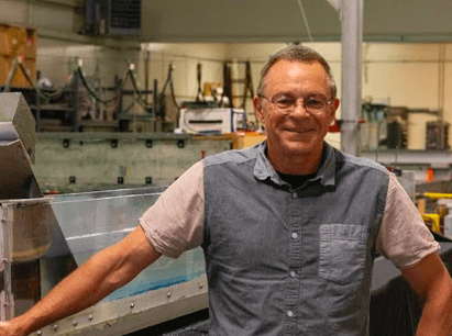
Professor Stephan Grilli stands with his model that depicts how volcanic eruptions cause tsunamis. Photo by Grace DeSanti.
A professor is working to prepare the Eastern Seaboard for catastrophic tsunamis
A massive tsunami could hit the East Coast of the U.S. one day, and a University of Rhode Island professor is taking charge by developing active evacuation maps and identifying high risk areas.
Stephan Grilli, chair of the Ocean Engineering Department, located at the University’s Bay Campus, has dedicated his life to studying and researching tsunamis.
“For about 10 years we have been working on developing inundation maps, just like hurricanes, but we do it for
These maps will help response teams plan coordinated actions in the event a tsunami does hit the East Coast.
“While the East Coast is a little less prone to tsunamis than other areas like Hawaii or the West Coast, still historically we have had tsunami,” Grilli said of the East Coast’s vulnerability to tsunamis.
One such East Coast tsunami occurred when a large earthquake in Puerto Rico sent a wave barreling toward the Eastern Seaboard. Additionally, in 1755, the city of Lisbon, Portugal was destroyed by an earthquake and later caused a large tsunami.
The tsunami then crossed over the Atlantic and was measured by Spanish colonists in the Carolinas to be about four meters tall. In 1929, the largest earthquake recorded on the East Coast rocked cities up and down the coast. Registering at 7.2 on the Richter Scale, it caused an underwater landslide north of Rhode Island in Newfoundland. This created a wave that hit the coast of Maine and caused 20 fatalities.
Grilli said that while historically there has been waves recorded hitting the East Coast, the biggest concern today is volcanic collapse from the Canary Islands.
“When you have a volcano growing quickly it becomes very steep, and periodically a piece of it falls into the water,” Grilli said.
Grilli specializes in this exact tsunami that would occur if collapse happens. In a worst case scenario, a chunk of land about 450 cubic kilometers would break off and plummet roughly a mile and a half into the water.
“If only one percent of that energy is transferred into the ocean, it is 60 megatons, like 4,000 Hiroshima bombs,” Grilli said.
Locally, in the Canary Islands, waves of 1,000 meters in elevation, which would be roughly a
Regionally, areas like Montauk and Long Island would be devastated, along with famous places like Atlantic City and the Jersey Shore. Grilli and associates at the National Oceanic and Atmospheric Administration (NOAA) walk these impact areas and access supposed damages.
While a collapse is expected, an exact date is not known. However, scientists say that it could happen as soon as tomorrow, or in thousands of years.
When Grilli is not helping prepare for and predict the East Coast tsunami, he is often found enjoying the ocean.
“I’m a big user of the ocean for fun, I’ve done everything, windsurfed for more than 40 years, I kitesurf, open ocean swims in the summer and it’s all that just gives you a passion for the ocean,” Grilli said.
Grilli also teaches graduate and undergraduate ocean engineering classes, and is always happy to see the success that graduates of the program have in life and in their careers.